Tagged: Maps
Highways & Countrysides – III
Journey Logs of Day 1 and Day 2 .
Day 3 of the journey was to the final destination, Hyderabad. With close to 600 kms to cover for the day and having had a good share of country sides and ghats traversed the previous day, decided to take NH7/44 for the last lug. Left Davengere to reach Bellary via Chitradurga. The road between Chitradurga and next major town Challekere is broken at many places. While travelling this 30 km stretch one can see Onion cultivation in it’s various stages ranging from just sowed to harvested through all possible stages of growth. No idea how much the farmers get paid for their hardwork compared to the high market price of Onions.
Contrary to expectations, Challakere, turned out to be pretty big and impressive town. Entrance to the town suggested that town be called “Oil city”, which I later figured out was from being 2nd largest producer of edible oil in India.The road from Challakere to Bellary is a dream stretch of 100 kms. Wider than many a National Highways in India, one can’t stop thinking that the road is laid out so that VIPs can ply between the mineral rich district to the capital city of Bengaluru in quick time. This stretch was also marked by thousands of acres of onion cultivation on both sides of the road.

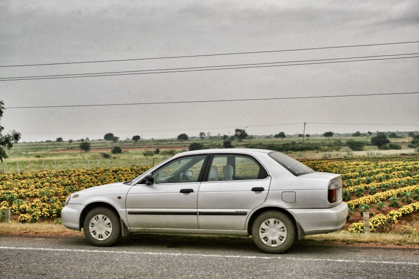
My trusted Highway Rider : 2006 Maruti Suzuki Baleno Lxi on Bellary Road in the backdrop of a Flower Plantation
Had breakfast from Bellary. I was slightly indecisive about the route to take from Bellary with slight bias towards taking the route via Raichur as that would be more scenic than the National highway. Decided against it though and headed towards Gooty to hit the Bangalore – Hyderabad NH there. No sales Tax/RTA checkposts at the state border crossings, this road too had thousands of hectares of onion cultivation among other crops being cotton, mustard etc. on either sides of the road. Rain was coming down heavily in small bursts by now. After the small town Gooty, hit the final NH with the last stretch of ~300 kms to final destination.
Excellent four/six lane toll roads with minimal traffic made me push back the driver seat bit more, lean back and relax. Nothing other than road side Dhabas to rely on till Kurnool. Once past Kurnool, there’s still hardly anything on the highway as it mostly bypasses whatever small towns and settlemets are there. Took a 15 km detour to visit Gadwal known for it’s unique weaving style. Entry to the small town will make you doubt if you are the right place, but right at the end of the town, one whole street stretching more than a km from Gandhi Chowk and it’s bylanes is marked by houses and shops selling Gadwal sarees.
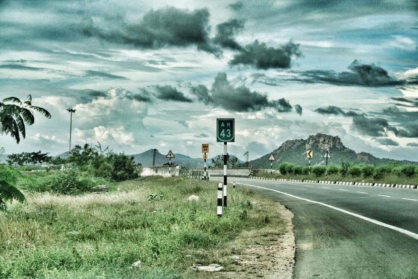
Hit back the highway to cover the last lug of th journey. Noticeable name change of National Highway 7 to it’s new number NH44 and not so frequent humble green and white boards mentioning that the road is alsoone of the four Asian Highways passing through India. This one being AH43 connecting India and Sri Lanka through the Palk Strait!
Reached home at Hyderabad by around 1830 hrs with heavy downpours on the ORR. clocking 1595 kms on the tripmeter. Thanks largely to the car for a completely glitch free ride despite having taken some rough terrains and Maps navigation for some good and some challenging route suggestions. All in all a great time on the road!. Nothing to complain much about other than slightly stiff back for next two days. 🙂
- Final Trip Meter Reading: 1595 kms (638 kms on Day 3)
- On Road Time Day 3 :13 hours.
- Average Fuel Consumption : 15.04 kms/litre (India does care for this!)
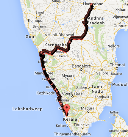
Thanks to Google Maps Location history, the entire route gets tracked with timestamps without any extra effort. Click on the image below for an interactive map with main waypoints.


